Oruro Department – Bolivia


Recommendations
Altitude 3700 masl
[tabby title=”Description” open=”yes”]
Oruro Department – Bolivia
Creation: The department was created by Supreme Decree on 5 September 1826, promulgated by the Marshal of Ayacucho Antonio José de Sucre.
Population: The department of Oruro, has 391.870 inhabitants (INE, census 2001).
Surface: The total area of the apartment is 53.588 KM2.
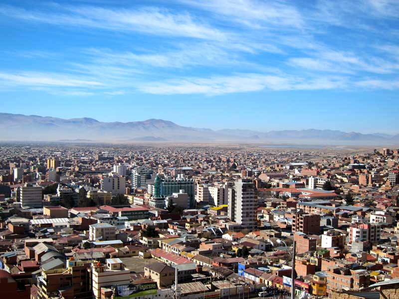
Capital: The city of Oruro is the capital of the department, founded on November 1, 1606 with the name of Real Villa de Austria. It has a population of 201.230 inhabitants. It is at a height of 3.702 m s.n.m. and his party is 10 February in commemoration of the indigenous revolution of 1781.
Political division: This department has 16 provinces, 175 cantons and 35 municipalities.
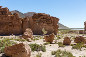
Geography: The department of Oruro occupies the central part of the Altiplano of Bolivia, It is located in the middle of the high plateau. The predominant topography is relatively flat, although much of the territory is mountainous, and there Mount Sajama rises majestically, with an elevation of 6,542 m.s.n.m. The city is surrounded by a mountain range with ten peaks, the highest being that of San Felipe. To the south extends Lake Uru Uru.
Boundaries: bordered to the north by the department of La Paz, to the south with the department of ‘ Potosi, to the east with the departments of Cochabamba and Potosí and to the west with the Republic of Chile.
Climate: The weather is cold almost all year round. Its average annual temperature is 9 degrees centigrade, reaching in summer up to 20° C in the mid-morning and part of the afternoon. The difference in minimum temperatures between winter and spring-summer exceeds 10 ºC.
Orography: The department is affected by the presence of the western or volcanic mountain range in its western area., bordering the republic of Chile, in which they stand out: the Sajama (6.542 m.), the mountain (in this case a volcano) highest in Bolivia) and the Payachatas (Pomarape 6.222 m. and Parinacota 6.132 m.). To the southwest the Sabaya mountain range is important..
Summits: Carabaya (5.869 m.) and Tata Sabaya (5.550 m.). The central area of the department of Oruro is part of the great high plateau. Towards the northeast, a segment of the Tres Cruces mountain range enters the department and parallel to the Uru – Uru and Poopó lakes runs the Azanaques mountain range., that divides the water of the Central and Lacustrine basins, of the Amazon and Plata. The main heights are: Black Pavilion (5.400 m.), bull summit (5.180 m).
Hydrography: It belongs to the central lake basin, Its main rivers are: Drain, that links Lake Titicaca with Lake Poopó; Tacagua;Sevaruyo y Juchusajahuira. Outside of Lake Poopó, there is also Lake Coipasa, which is also considered a salt flat in much of its extension..
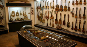
Main regional holiday: The Oruro carnival is unique in the world, for its religious meaning, which has a double root; on the one hand, the Andean-autochthonous region and, for another, the catholic, brought by the Spanish conquistadors. The carnival party is, above all, a tribute to the virgin, and the parishioners dressed in lavish costumes that, using masks decorated with vipers, lizards and toads (animals that the demigod Huari sent for the destruction of the Urus), They offer a spectacle of the fight of good against evil, in a performance of faith and popular theater.
Agriculture: The department of Oruro produces potatoes, quinoa, oca, length, barley and some vegetables. Cattle raising: Sheep farming is important, also camelid breeding: llamas, alpacas; in optimal conditions: cattle, equine and swine.
Mining: The department of Oruro has basically based its development on the mining industry; The mines with the highest production are Huanuni and, Colquiri. The department is rich in copper deposits, wolfran, antimony, zinc, sulfur, borax, lithium, etc. Foundries: A 6 km the installations of the tin and antimony smelting furnaces that currently melt 16,500 tons of tin and 4500 tons of antimony. Industry: The largest industry in the department of Oruro is extractive mining., also shoe manufacturing, soaps, pasta (noodles and cookies), millers, bricks and fine ceramics for construction.
Communication routes
Land: Daily bus service from the cities of La Paz, Potosi, Cochabamba, Sucre and Tarija. Also international service to the Republic of Chile (Arica, Iquique). It has a paved road to all these sections., except for the part corresponding to Cucho Ingenio (Potosi) - Taria, which, however, is in the middle of paving work.
Iron: From the border with the Republic of Argentina (Villazon) and the border with the Republic of Chile (Calama).
Ethnic Groups: The department was originally populated by Aymara and Quechua-speaking communities.; However, We can mention the Chipaya people as one of the most important., which is located in the highland area. The inhabitants of the region become hosts of the region of rich mountain landscape, hot springs, wildlife reserves, that preserve the species of camelids such as llamas, alpacas and vicunas.
Gastronomy: Roasted Face Head of lamb with leather, cooked in the oven. Fish Variety of fish-based dishes, especially the silverside.
History: Don Francisco de Medrano, towards the year 1585, He named a town called Ururu with the name of San Miguel de Oruro., notable for its development in ceramics, fame that extends from Venezuela to beyond Tucumán, in Argentina. On February 1, 1606, about what was the town of San Miguel de Oruro, the licentiate in canons and letters, judge of the hearing of Charcas, Don Miguel de Castro y Padilla, founded the Royal Villa of San Francisco of Austria. He 10 February 1781 revolution broke out against colonial tyranny, being headed by Don Sebastián Pagador, the Menachos and other patriots; the brothers Juan de Dios and Jacinto Rodríguez, They were the brains of the rebellion. He 6 October 1810 the strongest feat of emancipation took place, which was consolidated with the victory of Aroma, whose main protagonist was Esteban Arze. Finally, he 5 September 1826, during the presence of the Marshal of Ayacucho Antonio José de Sucre, The Department of Oruro was created.
[tabby title=”+Places”]
[do_widget id=arpw-widget-31]
[tabby title=”+info PDF”]
[gview file=”https://boliviaesturismo.com/wp-content/uploads/2015/10/Departamento-de-Oruro.pdf” cache=”0″]
[tabby title=”Tourism Companies”]
[do_widget id=arpw-widget-6]
[tabby end]
[do_widget id=rednao_smart_forms_widget-4]