Lagunillas – Holy Cross
“Che's route”. The dotted line marks the path of the guerrilla group led by Guevara to the place where he was shot.. Today it is a memory and tourist circuit.
Lagunillas
LAGUNILLAS MUNICIPALITY
HISTORICAL – CULTURAL HERITAGE OF SANTA CRUZ
First Municipal Section of the Cordillera province
Lagunillas, whose population is majority of Guaraní origin, It is dedicated to small-scale agricultural production and small-scale livestock farming aimed primarily at family consumption.. Its forest resources are not abundant and it has deposits of limestone and gypsum. They stand out with their handmade clay work, madera, leather and fabrics.
Nearby are the Isoso wetlands., where the Parapetí River draws its waters, enriching its agricultural and livestock production.
The declaration of Cultural Heritage of Santa Cruz, They make Lagunillas an interesting and attractive place for its stories, such as that of the Bolivian soldiers who crossed this hot territory during the Chaco War with Paraguay.. Likewise the battle that had to be fought with the legendary figure of “Che”, and the routes that this character followed through the communities of Ñancahuzú, Maguana Peña and others.
The topographic characteristics of the municipality correspond to the last foothills of the Andes Mountains., made up of small, moderately steep hills with flat regions, on which agricultural activities are carried out. The main rivers are the Parapetí, The road-cahuazú, Laguna Peña and Taparasi.
General data:
Foundation: It was founded by the priest Ramón Barba with the support of the local ranchers Manuel Anzaldo and Víctor Antezana in the year 1855.
Creation: Base Legal MR: Mention in Resolution of Date 17 March 1864.
Origin of the name: It adopts the name of Lagunillas due to the characteristics of its topography..
Political Division: Two cantons: Lagunillas and Aquio.
Geographic location: It is located at the foot of the Inca mountain range and southwest of Santa Cruz de la Sierra.
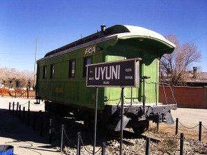
Access routes: Santa Cruz – Camiri paved road, It is linked by a secondary road that connects with Lagunillas, Monteagudo and Sucre. It is the Argentina – Bolivia railway route..
Distance: *It is located at 275 km. from Santa Cruz de la Sierra
Extension:
Population: 5.283 (INE data 2001)
FUENTE: https://www.santacruz.gob.bo/
[tabby title=”+Places” open=”yes”]
[do_widget id=arpw-widget-41]
[do_widget id=arpw-widget-37]
[tabby title=”Companies in Santa Cruz”]
[do_widget id=arpw-widget-42]
[do_widget id=arpw-widget-20]

[tabby end]