Incahuasi Island – Potosi
[sphere 327]

Recommendations
Getting to know the entire environment is an unforgettable activity since it has unique landscapes in the world., However, being at a high altitude between 3600 until 5000 mt tall, far from cities , with limited services and difficult roads, It is necessary to consider the following recommendations.
Due to the type of places, they must carry the following:
– Protector solar
– Small cut banknotes
– Sleeping bag
– Personal first aid kit
– sunglasses
– Long trouses
– Long sleeve t-shirts
– warm clothing
– Gloves
– Flashlight
– Lip cream
– Hand and face cream
– wool hat
– Sun cap
– Chalina
– hiking boots
Use.- Take care of your backpacks and always be attentive to anything.
Altitude 4000 – 5000 masl
Temperatura mine. -10 C – Max. 20 C
[tabby title=”Description” open=”yes”]
Incahuasi Island – Potosi
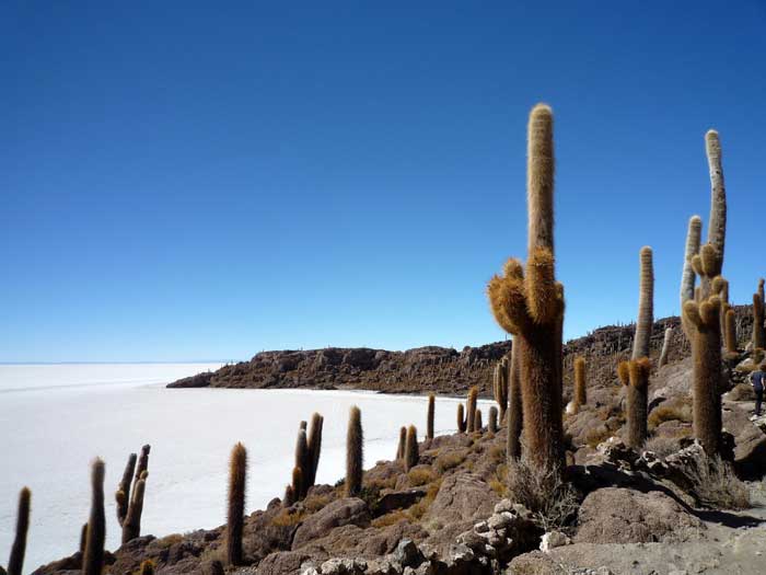
Incahuasi Island, In Quechua it means "the house of the Inca", It is a Bolivian island located in the central part of the Salar de Uyuni, department of Potosí.
Completely surrounded by the immense expanse of salt of the Uyuni salt flat., its relief is steep. There are a large number of giant cacti (Echinopsis atacamensis) which can measure more than 10 meters high.
It is one of the main tourist places in Bolivia, thanks to the attraction that the Uyuni salt flat represents, also known in the region as Salar de Tunupa, and it is the largest salt desert in the world. A tourist reception center belonging to the community of municipalities of Llica and Tahua operates on the island., in whose territory the island is located. At this center, visitors are charged an entrance fee to access a well-marked and easily accessible trail that runs around the island and allows you to enjoy the views over the salt flat., the cobalt blue sky and the hundreds of cacti.
The reception center does not offer the possibility of spending the night on the island. There is a restaurant with food and drinks typical of the Andes, although most tourists prefer to have lunch on the salt flat, a few hundred meters from the island, or using the tables made with salt tables that are on the edge of the island, with the menu included in tourist agencies. Trips to the island are organized from the town of Uyuni, located on dry land about 100 kilometers east.
Incahuasi Island is often mistakenly called the neighboring Pescado Island., which is located 22 kilometers northwest. The coordinates of Incahuasi are 20º14'34” south latitude and 67º37'31” about the length of the west, while those of Pescado Island are 20º08'35” south latitude and 67º48'27” about the length of the west.
[tabby title=”+Places”]
[do_widget id=arpw-widget-12]
[tabby title=”+info PDF”]
[gview file=”https://boliviaesturismo.com/wp-content/uploads/2016/01/salar-de-uyuni.pdf” save=”0″]
[tabby title=”Tourism Companies”]
[do_widget id=arpw-widget-6]
[do_widget id=arpw-widget-13]
[tabby end]
[do_widget id=rednao_smart_forms_widget-4]